Scenic Japan from the Water

Route Details

Kanaya Port~ Kurihama Port

  • Introduction of car ferry

    The car ferry comes and goes in the Tokyo Bay

    © Tokyo-Wan Ferry Co., Ltd.

  • Introduction of car ferry

    The car ferry comes and goes in the Tokyo Bay

    ©Yokosuka City

  • Introduction of car ferry

    The car ferry comes and goes in the Tokyo Bay

    ©Yokosuka City

  • Introduction of car ferry

    The car ferry comes and goes in the Tokyo Bay

    ©Yokosuka City

  • Introduction of car ferry

    The car ferry comes and goes in the Tokyo Bay

    ©Yokosuka City

  • Introduction of car ferry

    The car ferry comes and goes in the Tokyo Bay

    ©Yokosuka City

  • Introduction of car ferry

    The car ferry comes and goes in the Tokyo Bay

    ©Yokosuka City

  • Introduction of car ferry

    The car ferry comes and goes in the Tokyo Bay

    ©Yokosuka City

  • Introduction of car ferry

    The car ferry comes and goes in the Tokyo Bay

    ©Yokosuka City

  • Introduction of car ferry

    The car ferry comes and goes in the Tokyo Bay

    ©Yokosuka City

  • Introduction of car ferry

    The car ferry comes and goes in the Tokyo Bay

    © Tokyo-Wan Ferry Co., Ltd.

  • Peak of Mount Nokogiri

    An aerial cableway (ropeway) which climbs to a 330m elevation at the peak of Mount Nokogiri. There is a 360 degree panorma from the peak observatory.

    © Chiba Prefectural Tourism & Local ProductsAssociation

  • Sunset viewed from Futtsu Cape

    © Chiba Prefectural Tourism & Local ProductsAssociation

  • Introduction of car ferry

    The car ferry comes and goes in the Tokyo Bay

    © Tokyo-Wan Ferry Co., Ltd.

  • Introduction of car ferry

    The car ferry comes and goes in the Tokyo Bay

    ©Yokosuka City

  • Introduction of car ferry

    The car ferry comes and goes in the Tokyo Bay

    ©Yokosuka City

  • Introduction of car ferry

    The car ferry comes and goes in the Tokyo Bay

    ©Yokosuka City

  • Introduction of car ferry

    The car ferry comes and goes in the Tokyo Bay

    ©Yokosuka City

  • Introduction of car ferry

    The car ferry comes and goes in the Tokyo Bay

    ©Yokosuka City

  • Introduction of car ferry

    The car ferry comes and goes in the Tokyo Bay

    ©Yokosuka City

  • Introduction of car ferry

    The car ferry comes and goes in the Tokyo Bay

    ©Yokosuka City

  • Introduction of car ferry

    The car ferry comes and goes in the Tokyo Bay

    ©Yokosuka City

  • Introduction of car ferry

    The car ferry comes and goes in the Tokyo Bay

    ©Yokosuka City

  • Introduction of car ferry

    The car ferry comes and goes in the Tokyo Bay

    © Tokyo-Wan Ferry Co., Ltd.

  • Peak of Mount Nokogiri

    An aerial cableway (ropeway) which climbs to a 330m elevation at the peak of Mount Nokogiri. There is a 360 degree panorma from the peak observatory.

    © Chiba Prefectural Tourism & Local ProductsAssociation

  • Sunset viewed from Futtsu Cape

    © Chiba Prefectural Tourism & Local ProductsAssociation

Routes (Round-Trip)

From

Kanaya Port
Ports of Call

To

Kurihama Port

Fare [JPY]

360 - 1,320

Distance and Course Time

11.5km - 11.5km
/ 40M - 40M
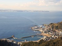
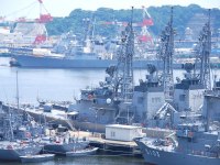
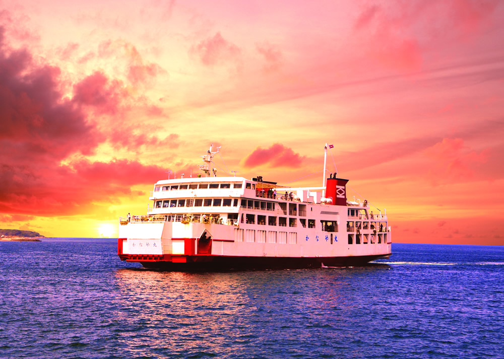
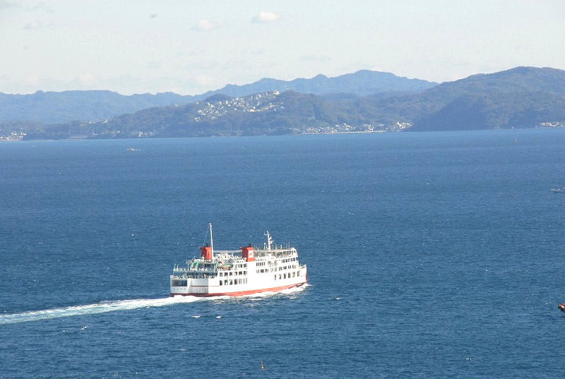
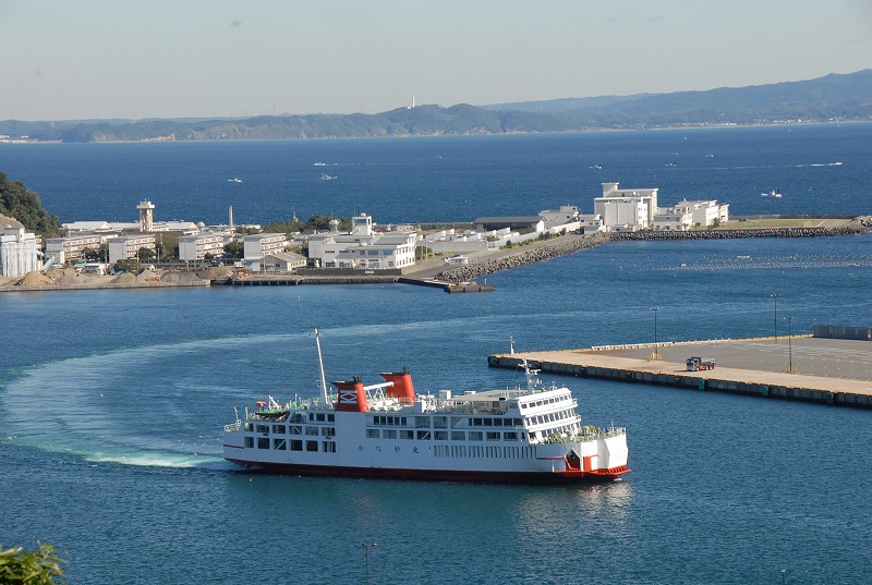
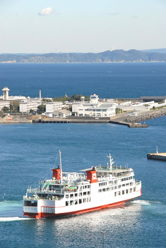
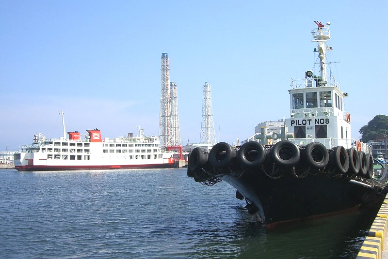
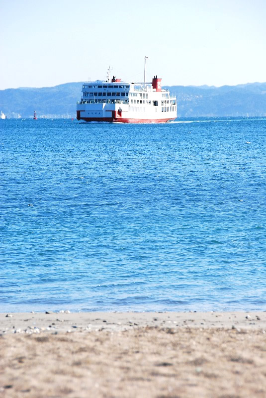
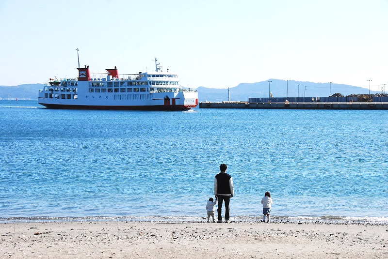
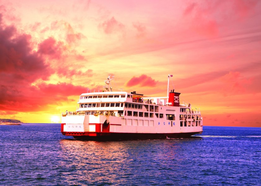
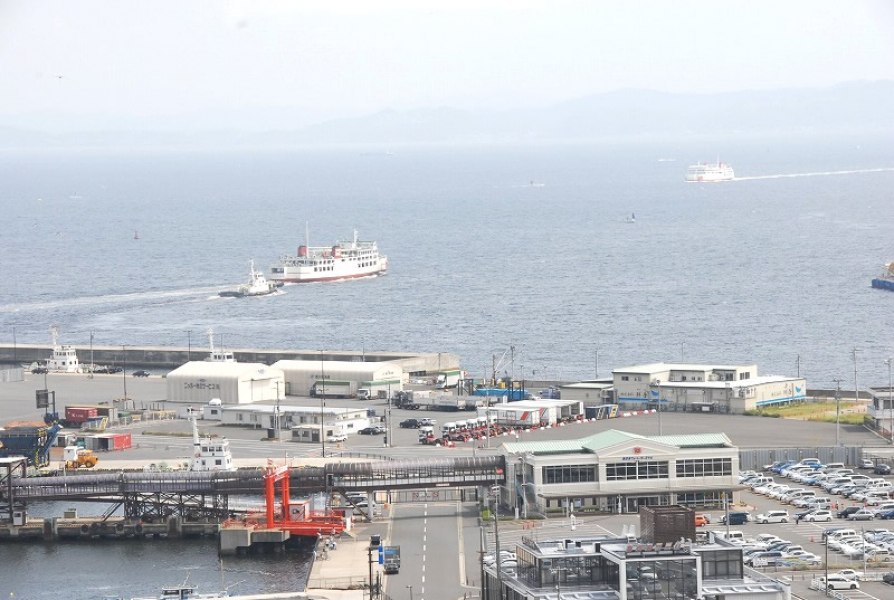
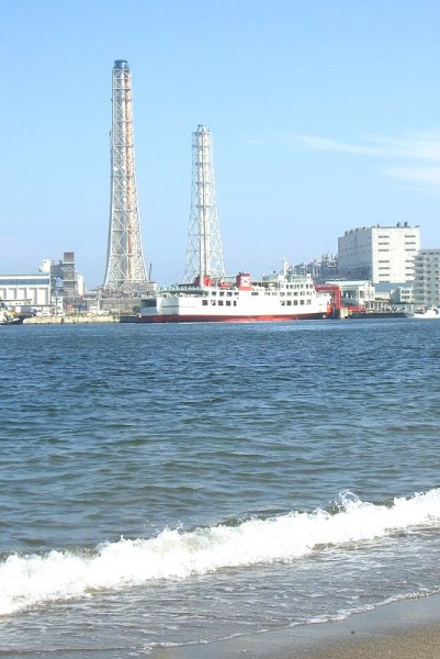
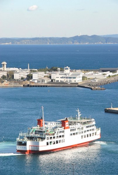
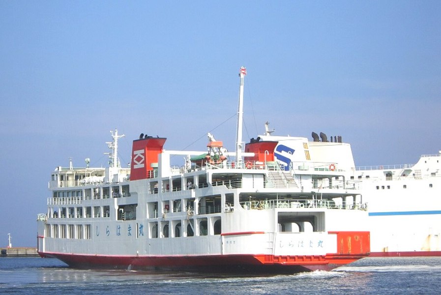
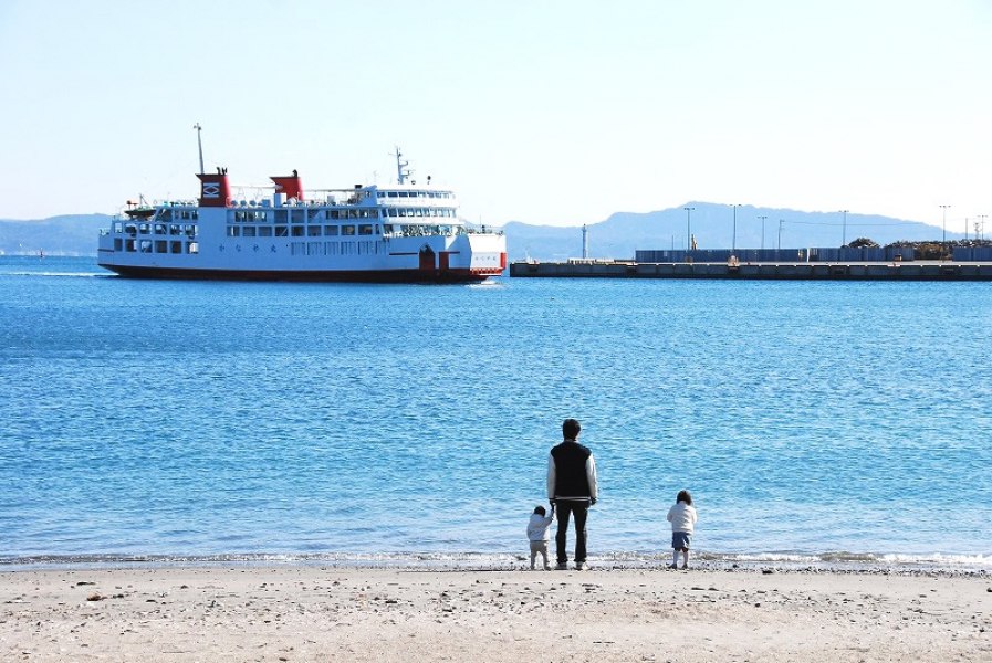
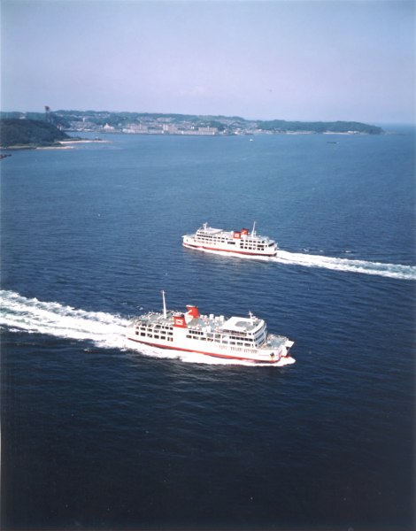
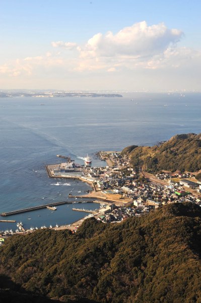
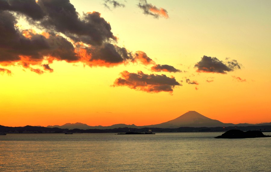
A regular car ferry service that connects Kanaya Port (Chiba Prefecture, Futtsu City) and Kurihama Port (Kanagawa Prefecture, Yokosuka City) in about 40 minute.

[Features]
The ship can carry up to 680 passengers and about 100 cars.
Inside, there are shops and an observation deck.
The line conveniently serves as a by-pass connecting the Boso Peninsula with the Miura Peninsula.
On board, you can enjoy the magnificent scenery with luxury liners and large freighters cruising around Tokyo Bay.
With some luck, you may catch nearby sight of aircraft carriers, Aegis warships or submarines. With a late afternoon service, you can also enjoy a beautiful“sunset cruise.”

[Tourist Attractions Nearby]
▪Kanaya Port
・Nokogiriyama: 13 minute walk from Kanaya Port to Nokogiriyama Ropeway Station. From the summit, you can enjoy an amazing view of Tokyo Bay.
・Nomizo Falls: 49 minute drive from Kanaya Port. Generating buzz on social media for being Ghibli-like, this waterfall is one of the most popular remote destinations of natural beauty in Chiba Prefecture.

▪Kurihama Port
・Yokosuka Port: 30 minute drive or 48 minute train ride from Kurihama Port. As a base of the Japanese Maritime Self-Defense Force and the American Navy, this port is the only spot in the country, where you can catch nearby sight of Aegis warships and aircraft carriers of both US and Japan.

[Access to Pier]
▪Kanaya Port
<By train> 7 minute walk from Hamakanaya Station of the JR East Uchibo Line.
https://goo.gl/maps/G5ksKzh1bvF2

<By car> 2 km (5 minutes) from the Futtsu-Kanaya IC of Futtsu Tateyama Road. Take the Prefectural Road 237, Uchibo-Nagisa Line, and then follow the National Highway127.
https://goo.gl/maps/Nrp4tbZUMGw

▪Kurihama Port
<By train> 2 minute walk from Keikyu Kurihama Station of the Keikyu Kurihama Line.
1 minute walk from the Tokyo Bay Ferry stop of Keikyu Kurihama Bus (Keikyu Bus)
https://goo.gl/maps/2dRUy18yTmn

<By car> 5 km (16 minutes) from the Sahara IC of Yokohama-Yokosuka Road. Follow the Prefectural Road 27.
https://goo.gl/maps/XQsKaiHwwe92

[Vessel Operator]
Tokyo-Wan Ferry Co., Ltd. 
Items of Interest Car Ferries Route Type Car Ferries
Reservation No Credit Card Yes
Contact Information Tokyo-Wan Ferry Co., Ltd.
TEL: 046-830-5622 ( Japanese Only )
6:00~20:00
Details

Ports of Call

  1. Kanaya Port
  2. Kurihama Port

Click the port of call and it will appear on the map

Tourist Attractions Nearby

Futtsu
Yokosuka